Science Friday on Mass Transit

Image from Flickr User neoporcupine


NPR's Science Friday recently held a discussion on mass transit, asking how it can play a role in reshaping sprawl.  Guests to the discussion include:
Yonah Freemark
Associate, Metropolitan Planning Council
Writer, Transport Politic blog
Chicago, Illinois
Stefanos Polyzoides
Founding member, Congress for the New Urbanism
Architect, Moule & Polyzoides
Pasadena, California
Ian Carlton
Doctoral candidate, UC Berkeley
City and regional planning
Visit Science Friday to listen.

FHWA Endorses New Non-motorized Design Guidelines


A recent memo from the Federal Highway Administration has endorsed a new set of flexible design standards for bike and pedestrian infrastructure.  The new standards come from the National Association of City Transportation Officials (NACTO), and provide alternatives more frequently found in Europe.  The new design endorsements are important because local officials and staff are hesitant to implement solutions not endorsed by professional engineering organizations.  Most importantly, the new endorsement encourages and provides guidance for building protected bike lanes (see picture above).  To view some of the new design solutions, visit the NACTO website.  Or to find out more about he policy changes, read a summary at DC Streetsblog.

Race and Geography in America


A new map from University of Virginia demographic researcher Dustin Cable is a striking portrait of race and geography in America.  The map includes 308,745,538 individual dots, representing each and every American.  The dots are themed by race based on data collected by the US Census.  We've included a screenshot of Washtenaw County below.  Visit the map yourself at the Cooper Center or Public Service website.


Good Transit Might Make You Happier

Image by Flickr user chief_huddleston
A recent study out of the University of Minnesota  found that living near high quality transit service has real impacts on reported levels of happiness.  Researcher Jason Cao, an transportation policy scholar, questioned households along Minneapolis' Hiawatha light rail line, a 12 mile line connecting downtown to the Mall of America, regarding satisfaction with transit service and life in general.  There was improvement in overall happiness along the rail corridor when compared to locations with poor transit service or no transit service.

Learn more about this study at The Atlantic Cities, or purchase the full study at the journal Transportation.

Smithsonian's Before and After of Great American Cities


The Smithsonian Institute put together an impressive series of maps that let you compare cities geographys to maps throughout their past.  The map above comes from a map that compares present day Chicago to a 1868 pocket map of the city.  The maps were built using ESRI's suite of web maps.  Other maps include historical comparisons in Denver, LA, Washington DC, San Francisco, and New York City.  (Hint: the magnifying glass moves as well.)

Detroit News: U.S. extends connected vehicle pilot program in Ann Arbor

The National Highway Traffic Safety Administration is extending a pilot project in Ann Arbor on connected vehicles by another six months, but said it won't change its timetable for deciding whether to move forward with the new technology.


The project was initially supposed to last a year when it was kicked off in August 2012 by Transportation Secretary Ray LaHood and Gov. Rick Snyder with nearly 3,000 "smart cars" that could one day revolutionize auto safety. Cars, for example, could alert each other that a driver was about to miss a stop sign or pull onto a busy street. Or that a vehicle has entered a driver's blind spot.

NHTSA will use the results from the vehicle-to-vehicle safety pilot to decide by the end of the year whether to advance the technology through regulatory proposals, additional research, or a combination of the two.
UMTRI has been conducting the test of approximately 2,800 cars, trucks, and buses.

TheRide's FootballRide Shuttles to Begin August 31

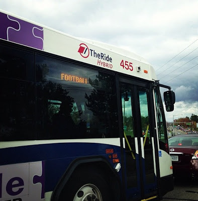
TheRide will begin a new FootballRide shuttle season with the August 31 University of Michigan game against Central Michigan University.


The service will operate between many convenient hotel and parking sites and Michigan Stadium for seven home football games this fall.  Additional hotels will also be served indirectly at nearby pick-up sites.  Hotel parking may be limited to hotel patrons.

FootballRide runs approximately every 20 minutes starting two hours before game time with the last shuttles leaving 30 minutes before game time.  Return shuttles run for approximately one hour after each game.

FootballRide tickets are $1.50 each way for adults and may be purchased at most of the hotel sites, or in advance by mail or in person at TheRide’s main office at 2700 South Industrial Highway in Ann Arbor.  Riders are encouraged to purchase round-trip tickets, as drivers do not carry change. Reduced fares are available for those who qualify.

Boarding Locations
Free Park & Ride Lot Shuttle Stop Locations:
  • Plymouth Road Park & Ride Lot (North Shuttle)
  • Miller Road Park & Ride Lot (West Shuttle)
Public Paid Parking Shuttle Stop Locations (Downtown Shuttle):
  • Fletcher Street Parking Structure
  • Fourth & William Parking Structure
  • Pizza House (for Forest Street & Church Street Parking Structures)
  • Thompson Street Parking Structure
Hotel and Other Shuttle Stop Locations
* Indicates ticket sales locations

North Shuttle Stop Locations
  • Holiday Inn near the University of Michigan (parking for Guy Hollerin’s restaurant and hotel guests only)*
South Shuttle Stop Locations
  • Sheraton Ann Arbor Hotel*
  • Hampton Inn South*
  • Kensington Court Ann Arbor*
  • Red Roof Inn*
  • Comfort Inn & Suites – board at Red Roof Inn*
  • Courtyard by Marriott – board at Sheraton*
  • Fairfield Inn – board at Sheraton*
  • Holiday Inn Hotels & Suites – board at Sheraton*
  • Holiday Inn Express (tickets available at Kensington Court)
Downtown Shuttle Stop Locations
  • Bell Tower Hotel*
  • Campus Inn*
  • Michigan Union
East Shuttle Stop Locations
  • Ann Arbor Regent Hotel & Suites (Carpenter Road)*
  • Days Inn*
  • Comfort Inn (tickets available at Days Inn, Board at Days Inn)
West Shuttle Stop Locations
  • Weber’s Inn (parking for Weber’s patrons only)*
  • Clarion Hotel*
During each home game, Routes 6, 7, 8, 15, and 16 will be detoured while the streets are closed to through traffic.

Football Ride information is available on TheRide’s web site, TheRide.org, and by phone at 734.996.0400.

Game-day Street Closures Beginning Saturday August 31


In an effort to enhance overall security around Michigan Stadium, the Ann Arbor City Council has authorized street closings in the vicinity of Michigan Stadium on all football Saturday home game days this season, beginning with this Saturday, Aug. 31.

Scheduled lane closures include: East Keech Street between South Main and Greene streets, limiting access to parking permit holders on Greene Street from East Hoover to Keech streets; the westbound right-turn lane on East Stadium Boulevard (onto South Main Street) just south of the Michigan stadium; South Main Street between Pauline and Stadium. The duration of these closures will be three hours before each home football game until the end of each game, with the exception of southbound South Main Street, which will be closed one hour prior to the game until the end of each game. This will enable patrons to access neighborhood parking areas west of the stadium. Provisions will also be made for properties with access exclusively on Main Street.

Traffic will be detoured using Pauline Street and Seventh. After the game, or at the discretion of the Chief of Police, barricades will be removed as soon as practical, and Main Street will reopened.