
Smithsonian's Before and After of Great American Cities
/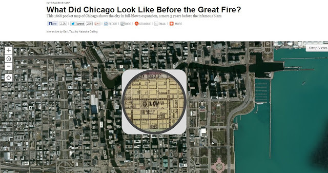
The Smithsonian Institute put together an impressive series of maps that let you compare cities geographys to maps throughout their past. The map above comes from a map that compares present day Chicago to a 1868 pocket map of the city. The maps were built using ESRI's suite of web maps. Other maps include historical comparisons in Denver, LA, Washington DC, San Francisco, and New York City. (Hint: the magnifying glass moves as well.)


